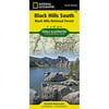
National Geographic TI00000238 Map Of Black Hills SE - South Dakota

National Geographic TI00000238 Map Of Black Hills SE - South Dakota

Model: TI00000238

Brand: National Geographic

(1) 1 shops 0 products

Detailed product description

This Trails Illustrated Topographic Map For South Dakota'S Black Hills, Wind Cave National Park, Mt Rushmore, And Surrounding Area, Is The Perfect Map For Exploring This Magical Wilderness. The Map Includes Wind Cave National Park, Custer State Park, Black Hills National Forest, Norbeck Wildlife Preserve, Sylvan Lake, Stockade Lake, Legion Lake, Center Lake, Elk Mountain, Bison Flats, Limestone Canyon, And Much More. Includes Utm Tick Marks For Use With Your Gps Unit. Approximately 4.25'' X 9.25'' Folded; 26'' X 38'' Fully Opened Scale = 1:70,000.


Compare buying offers


Search
Amazon Amazon

Currently Unavailable - Out of Stock

We don't know when or if this item will be back in stock. Please check back later for updates.

Product specifications

Technical details

Manufacturer -
Brand National Geographic
Item model number TI00000238
Color Green
Weight -
Height -
Depth -

Additional product information

Product Id 1474526
User Reviews and Ratings 3 (1 ratings) 3 out of 5 stars
UPC 749717002388

Compare buying offers


# Title Reviews User Ratings Price
1
Search on Amazon
Price:
Search on Amazon
Search on Amazon

Similar Products View All


arrow_upward