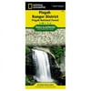
National Geographic TI00000780 Map Of Pisgah National Forest - North Carolina

National Geographic TI00000780 Map Of Pisgah National Forest - North Carolina

Model: TI00000780

Brand: National Geographic

(1) 1 shops 0 products

Detailed product description

Coverage includes Pisgah National Forest Shining Rock and Middle Prong wilderness areas Bent Creek Research and Demonstration Forest North Carolina Arboretum Blue Ridge Parkway Mountains-to-Sea Trail Looking Glass Rock Cold Mountain Sliding Rock and Mount Pisgah recreation areas Looking Glass Falls and Cradle of Forestry in America National Historic Site. Towns - Asheville Waynesville Brevard. Includes UTM grids for use with your GPS unit and a trail mileage matrix. Approximately 4.25in x 9.25in folded and 25.5in x 37.75in fully opened.

This Trails Illustrated Topographic Map Is The Most Comprehensive Recreational Map For North Carolina'S Pisgah Ranger District Area. Coverage Includes Pisgah National Forest; Shining Rock And Middle Prong Wilderness Areas; Bent Creek Research And Demonstration Forest; North Carolina Arboretum; Blue Ridge Parkway; Mountains-To-Sea Trail; Looking Glass Rock; Cold Mountain; Sliding Rock And Mount Pisgah Recreation Areas; Looking Glass Falls; And The Cradle Of Forestry In America National Historic Site.


Compare buying offers


Search
Amazon Amazon

Currently Unavailable - Out of Stock

We don't know when or if this item will be back in stock. Please check back later for updates.

Product specifications

Technical details

Manufacturer -
Brand National Geographic
Item model number TI00000780
Color -
Weight -
Height -
Depth -

Additional product information

Product Id 1474531
User Reviews and Ratings 3 (1 ratings) 3 out of 5 stars
UPC 749717007802

Compare buying offers


# Title Reviews User Ratings Price
1
Search on Amazon
Price:
Search on Amazon
Search on Amazon

Similar Products View All


arrow_upward