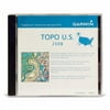
Key Features and Benefits: Includes topographic coverage of the entire United States, including Alaska, Hawaii and Puerto Rico Provides detailed digital topographic maps, comparable to 1:100,000 scale USGS maps Contains summit locations with elevation, coastlines, lake and river shorelines, wetlands and perennial and seasonal streams Allows you to search by city, geographic point, summit, lakes and more Provides elevation profile on compatible Garmin devices so you can estimate terrain difficulty Contains many routable trails, rural roads, city neighborhood roads, major highways and interstates Displays national, state and local parks, forests and wilderness areas Includes points of interests such as parks, campgrounds, scenic lookouts and picnic sites
| Manufacturer | - |
|---|---|
| Brand | Garmin |
| Item model number | 2008 |
| Color | - |
| Weight | - |
| Height | - |
| Depth | - |
| Product Id | 944130 |
|---|---|
| User Reviews and Ratings | 3 (1 ratings) 3 out of 5 stars |
| UPC | 753759073855 |
| # | Title | Reviews | User Ratings | Price |
|---|---|---|---|---|
| 1 |
Search on Amazon
Price:
Search
on
|
Search
on
|
||
| 2 |
MapSource TOPO U.S. 2008 - Maps
Price:
$87.49
on
|
(4.3) |
$87.49
on
|
We bought this along with our Garmin 60csx. I am so happy that we decided to purchase this disk. It has a great topo map with trail routes, streams, lakes and water ways. Along with all side streets. You can choose which areas to download. Easy to use and download. I am so glad we added this to our purchase. Would definitely recomend.
I bought this product for use with my GPSMap60Csx. Provides much more detail than the basemap that came already loaded on the unit. Well worth the money.
Use this mapping software primarily for kayaking. Have been pleased with the detail and ease of use. Obviously won't have every little stream and landmark, but was pleasantly surprised when Turner's Fish Camp was shown. It's not exactly a major destination. Will be especially interested to see future updates.
Your product has a lot of good detail in the maps for what was described as 100k scale based. I was very pleased to see how well you can zoom in and the details of the maps are very practical. 25 ft between contour interval lines. It shows all of the small streams, mountains, ponds, rail tracks, etc. for all of the US. Very powerful. This will help me a lot in deer hunting and bushwacking my way in wilderness areas. I am very pleased with this product. It was easy to select the content I wanted and to download it to the micro SD card for my GPS Etrex Vista HCx. Thank you for putting this product out.
This product is very useful for anyone interested in mapping in general, or geocaching, etc. It works quite well on a PC computer, and downloaded to my Garmin GPSmap 76CS unit. It is a big improvement over the older Garmin MapSource United States TOPO version which I also own and have used for several years. My only complaint about the product is that I have noticed a few geographic name errors. The author needs to have input from users with "ground truth."
Installation on PC was easy. Copying maps to my Garmin 60 handheld was even easier. Draw a box around the map section you want to copy. Hook up the GPS and push the button. That simple. Good detail for what I was hoping. I use the Topo maps for the boat to identify rivers and streams.
I bought this product to go with my Garmin hanheld GPS. I wanted both roads and topographic capabilities. The only shortfall is that you can not look up individual roads. It has all of the roads, all the way down to rural driveways. It is very complete. I just wish it was a little more road friendly.
Only had this cd for a few weeks and have not taken it out on a field run yet but I have played with it a little around the house, its easy to transfering to my Garmin memory card, planning your route on the computer is simple. I like to go fishing so I am hoping to keep track of the best fishing spots with it. Its a very must for the person that likes to explore, hunt or fish..
The shopping experience was easy and delivery was quick. The Garmin map product is top-notch all the way. My only complaint is with the price that Garmin demands for their product. The mapping software generally doubles (or more) the price of the handheld gps unit (which is useless without the add-on maps).
Very inaccurate maps. Did not look like the pictures on the internet. Street/neighborhood maps are of by over 200 feet. They are worthless. One of the worst programs I have ever bought!