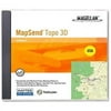
Magellan MapSend Topo 3D US - V. 1.0 - GPS software - for eXplorist 400, 500, 600

Magellan MapSend Topo 3D US - V. 1.0 - GPS software - for eXplorist 400, 500, 600

Model: Topo 3D US

Brand: Magellan

(1) 2 shops 1 products

Detailed product description

Magellan MapSend Topo 3D US - 1.0 - GPS software

Magellan MapSend Topo 3D USA v.1.0 Distribution Media/Method: CD-ROM Platform Supported: PC Distribution Media/Method: CD-ROM Platform Supported: PC Software Name: Magellan MapSend Topo 3D USA v.1.0 Software Sub Type: Maps/GIS Software Name: Magellan MapSend Topo 3D USA v.1.0 Software Sub Type: Maps/GIS Software Main Type: Reference Software Main Type: Reference


Compare buying offers

Last updated: 2024-08-25 11:07:21
Search
Amazon Amazon

$55.2
walmart walmart

Product specifications

Technical details

Manufacturer -
Brand Magellan
Item model number Topo 3D US
Color -
Weight -
Height -
Depth -

Additional product information

Product Id 944100
User Reviews and Ratings 3 (1 ratings) 3 out of 5 stars
UPC 763357109719

Compare buying offers


# Title Reviews User Ratings Price
1
Search on Amazon
Price:
Search on Amazon
Search on Amazon
2
Magellan MapSend Topo 3D US - V. 1.0 - GPS software - for eXplorist 400, 500, 600
Price:
$55.2 on walmart
(3.1)
$55.2 on walmart

Top User Reviews and Ratings

Magellan MapSend Topo 3D USA CD-ROM
(5)
Reviewed in the USA on 2008-05-14T17:00:00

Excellent product. I do alot of hiking in the National Parks. I used my Magellan with topo software loaded for the first time this week. It really was helpful having the topo information available. One point though. You loose the topo detail when you zoom out beyond 1.6 miles. Probably because the display cannot handle the detail of information unless the zoom is set at less than 1.6 miles. Because of this you loose a little of the "big picture" ability, but again having the topo information is really wonderful.

ESchnei781 . Review provider: walmart.com
Excellent Product
(5)
Reviewed in the USA on 2008-05-12T17:00:00

If you desire fine detail on a hand held GPS this is the product for you. Accuracy is exceptional. Popped in a 512 SD card in my Magellan Meridian Platinum just to make sure I had enough RAM. Product is user friendly and well worth the money. Adds versatility to your GPS.

HunterinColorado . Review provider: walmart.com
GPS map
(5)
Reviewed in the USA on 2008-04-10T17:00:00

The directions with the product were sketchy at first glance but I found it easy to install and use with my Magellan 500LE. It has exceeded my expectations and I am having a great time using my GPS thanks to this map program. Wal-Mart had the best price of any place I could find on the web. Thanks!

plantlady095 . Review provider: walmart.com
Overall excellent
(4)
Reviewed in the USA on 2008-01-30T16:00:00

Good detail at around the 1:50,000 level (more than 1:100,000 and less than 1:24,000 so I'm guessing here). Not many trails marked but decent gravel road maps, on the level of a DeLorme Gazetteer. Reasonably easy to use interface and no trouble downloading maps to my unit, which is an eXplorist 210. You gotta read the directions, though, because isn't intuitive. One important complaint which I have not seen voiced elsewhere: mountains. For some reason any high mountain seems to be covered in water, randomly distributed water. You cannot remove this water and it obscures the contour lines. I have no idea what the glitch is. It's not supposed to be glaciers because they're designated differently and unobtrusively. It is the strangest thing. Magellan Customer Service is useless in the matter. They kept thinking I had dropped my GPS into water on the top of a mountain when I explained it to them. Otherwise excellent product at a reasonable price.

penoyar . Review provider: walmart.com
Topo software
(4)
Reviewed in the USA on 2008-03-17T17:00:00

Have owned sportrak topo gps and now explorist, this software provides great topo and road detail comparable to the basemap of my sportrak. Although there are some roads missing, but if find this mainly due to accelerated industrial and residential development, not errors in the sofware.

Dae155 . Review provider: walmart.com
Good Maps
(4)
Reviewed in the USA on 2008-02-18T16:00:00

The maps are very good. Don't expect any off-road trails such as biking or hiking trails. The one bad point is that CD #3 must be in your CD drive for Mapsend to run. I am getting flaky errors and sometimes have a problem getting it to run because of CD-ROM errors.

DanofSJC . Review provider: walmart.com
Topo USA
(3)
Reviewed in the USA on 2008-04-06T17:00:00

This package is really the only choice if you want street maps on your Magellan Explorist. The software and instructions are primarily written and designed for other models Magellan makes but there is a supplemental instruction sheet in the box for Explorist users. Once I finally found this sheet, I was much happier, as the software not not working for me otherwise. I still had technical issues after that primarily due to extremely slow transfer times. It took over 3 hours to transfer 20 MB of data. I'm pretty sure this was due to my USB drivers however as others I know of that have used this product have not experienced this slowness. Choosing a map region is very easy and it is clear how to use the software, just a little tricky getting the data onto the explorist. There is also no real guideline regarding how large a map file should or should not be. The largest single file I had was 13MB and I was able to transfer that without a timeout from the unit, and it seems to load it quickly once it was on the unit, but I'm sure it can handle larger. If you purchase this software, start will small file sizes (a city) and work your way up until you find a size that is suitable for you. I got up to about half a state worth (Southern WI) The last thing is that it comes on 3 CDs. If you do the minimal installation, you'll need to insert the 3rd CD every time you use the software. This is a pain. But my hard drive wasn't big enough to spare the room. I tried copying the 3rd CD to have as a backup I could keep at the desk and keep the rest is safe storage. But it would not accept the copy. So I hope nothing goes wrong with the disk. I may be able to get the copy to work, but haven't tried yet. I also opted to not include POIs with the regions I created. The POIs made such a mess on the screen that I could not see the roads in the cities. I'm sure there must be a better way to manage them on the unit but I wasn't able to figure it out in a timely manner. Not including the POIs also saves space. I use other mapping software for that stuff anyway. My primary use for the Explorist is for GeoCaching. I got topo for the streets so I could navigate to the caches easier. This saved me from making printed maps. So far I have been glad to have the extra roads and ease of navigation. Most of the roads, even the back roads of Wisconsin, have been pretty accurate. With this software, you also get the added benefit of more accurate shorelines. The river is no longer a slender blue line that meanders across the screen but each shoreline is well defined and accurate. If you're looking at this topo software for it's topo capabilities though, look elsewhere. The topo you get on the unit is very course and not nearly as accurate as the topo you see in the software on the PC. You don't even get 10 foot increments. They are more like 50 foot if you're lucky and they are not accurate. But if you extract your trip or track or path or whatever from the unit and import it into the software, then you have a good post-trip analysis tool that could be useful... but so much if you're on the trail. Would not be real helpful when backpacking, but would be better than nothing.

BetterShopAround111 . Review provider: walmart.com
Magellan MapSend Topo
(2)
Reviewed in the USA on 2007-09-23T17:00:00

This is a mediocre to poor topographical map program. The utilities are cumbersome and the maps seem more like a road atlas with convenience stores listed. The detail is poor and the rural roads listed are sparse with questionable accuracy.

Sunfish . Review provider: walmart.com
Mapsend old technology at a modern price
(1)
Reviewed in the USA on 2008-01-10T16:00:00

Dissapointing map detail and cd must installed in the computor to look at maps. Not user friendly and not worth the price. Advise people not to buy and to return the magellan product to place of purchess. In fact my whole experiance with magellan products has been a let down.

DesertJeepster . Review provider: walmart.com
the worst software
(1)
Reviewed in the USA on 2007-11-24T16:00:00

This is the most cluncky software design I have ever experenced. They need to go back to the drawing board on this title. It appears that that they added extra progams to an existing program to convert and make old software compatable with newer design devices instead of re-writting new sofware for the new and improved GPS that are now in the market place. If you have an explorist and the upload jambs which is a common occurrance you will need to send your unit in for repair. This is only covered for the first year, you will pay shipping and it will take 2 to 4 weeks to get your unit back. this repair could be done over the internet but magellan will not do.

bill52 . Review provider: walmart.com

Similar Products View All


arrow_upward