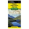
Sequoia and Kings Canyon National Parks (National Geographic Trails Illustrated Map) - National Geographic

Sequoia and Kings Canyon National Parks (National Geographic Trails Illustrated Map) - National Geographic
(1) 1 shops 0 products

Detailed product description

Waterproof ?¦= Tear-Resistant ?¦= Topographic Map Some Highlights Of The Map Include: Highest Peak In Continental U.S. - Mt. Whitney; Sequoia Grove Boundaries; Giant Sequoia National Monument; John Muir, Golden Trout, Jennie Lake And Monarch Wilderness Areas; John Muir Trail And Pacific Crest Trail. Includes Utm Grids For Use With Your Gps Unit.


Compare buying offers


Search
Amazon Amazon

Currently Unavailable - Out of Stock

We don't know when or if this item will be back in stock. Please check back later for updates.

Product specifications

Technical details

Manufacturer -
Brand National Geographic
Item model number -
Color -
Weight -
Height -
Depth -

Additional product information

Product Id 1474517
User Reviews and Ratings 3 (1 ratings) 3 out of 5 stars
UPC 749717002050

Compare buying offers


# Title Reviews User Ratings Price
1
Search on Amazon
Price:
Search on Amazon
Search on Amazon

Similar Products View All


arrow_upward