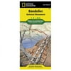
Trails Illustrated Topo Map: Bandelier National Monument - New Mexico, USA (Trails Illustrated - Topo Maps USA) - Nation

Trails Illustrated Topo Map: Bandelier National Monument - New Mexico, USA (Trails Illustrated - Topo Maps USA) - Nation

Model: TI00000209

Brand: National Geographic

(1) 1 shops 0 products

Detailed product description

Included On The Map Are Santa Fe National Forest, Bandelier Wilderness, Dome Wilderness, Canon De Los Frijoles, Capulin Canyon, The San Miguel Mountains, Sanchez Canyon, Alamo Canyon, Lummis Canyon, White Rock Canyon, Cochiti Canyon, And Portions Of The Rio Grande River. The Map Also Includes Historical And Archaeological Information About The Monument, As Well As Information For Its Flora And Fauna. Approximately 4.25'' X 9.25'' Folded; 26'' X 38'' Fully Opened Scale = 1:28,600.

Scale 1:28 Scale 1:600


Compare buying offers


Search
Amazon Amazon

Currently Unavailable - Out of Stock

We don't know when or if this item will be back in stock. Please check back later for updates.

Product specifications

Technical details

Manufacturer -
Brand National Geographic
Item model number TI00000209
Color Multicolor
Weight -
Height -
Depth -

Additional product information

Product Id 1474518
User Reviews and Ratings 3 (1 ratings) 3 out of 5 stars
UPC 749717002098

Compare buying offers


# Title Reviews User Ratings Price
1
Search on Amazon
Price:
Search on Amazon
Search on Amazon

Similar Products View All


arrow_upward