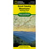
Trails Illustrated - Topo Maps USA S: Great Smoky MTS - Nat'l Parks (Hardcover)

Trails Illustrated - Topo Maps USA S: Great Smoky MTS - Nat'l Parks (Hardcover)
(1) 1 shops 0 products

Detailed product description

America'S Most Visited National Park Straddles Tennessee And North Carolina With Its Seemingly Endless Forest. The Map Includes The Park In Its Entirety; The Appalachian Trail; Twentymile Trail; Lakeshore Trail; Chasteen Creek Trail; The Great Smoky Mountains; Chilowee Mountain; Little Mountain; The Blue Ridge Parkway; Cataloochee Divide; Pisgah National Forest; Cherokee National Forest; Nantahala National Forest; Little Tennessee River; Chilhowee Lake; Fontana Lake; Tuckasegee River; The Cities Of Maryville And Gatlinburg Tennessee, And Waynesville, North Carolina; Utm Grids For Use With Your Gps.


Compare buying offers


Search
Amazon Amazon

Currently Unavailable - Out of Stock

We don't know when or if this item will be back in stock. Please check back later for updates.

Product specifications

Technical details

Manufacturer -
Brand National Geographic
Item model number 229
Color -
Weight -
Height -
Depth -

Additional product information

Product Id 1474521
User Reviews and Ratings 3 (1 ratings) 3 out of 5 stars
UPC 749717002296

Compare buying offers


# Title Reviews User Ratings Price
1
Search on Amazon
Price:
Search on Amazon
Search on Amazon

Similar Products View All


arrow_upward